Highlands and Lowlands
Understanding
MOLA Data
This project involved Montessori School of Corona students from pre-school through 7th grade. The first step was to create an Earthscape that could be measured similar to the the way the Mars Orbiting Laser Altimeter measures the elevations on Mars.
 |
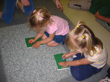 |
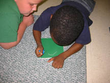
Preschool and Kindergarten students punched out continent shapes using a method common in Montessori classrooms. Each student used a pushpin to punch along the outline of the continent shape. To create height, we used foam board instead of the construction paper usually used for this task. The students used oversized pushpins to punch through the foam board.
 |
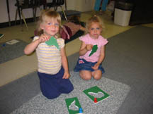 |
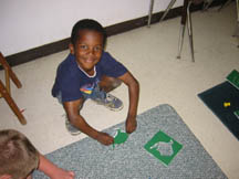
When they finished, the children proudly displayed their work. The actual continent shapes were used for the next step of the procedure, but notice that you could use the outer negative shape as a template for other variations on this project. See the Appendix for more ideas.
 |
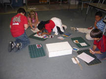 |
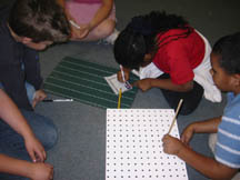
The continents were glued onto another piece of foam board. Using a box created from pegboard, the first and second grade students used wooden dowels to measure the unknown surface and then graph their data onto quadrille paper. Before the hidden landscape was revealed to them, they were asked to draw what they thought was hidden in the box. They were very surprised to see what they were mapping was Earth!
[NOTE: Anything the teacher says before the students begin this task, puts thoughts in their heads about what is in the box. I discussed Mars and planets so the guesses were related to what we had discussed. If you want a totally "blind" measurement, it might be better not to tell them anything until later.]
| Home | Contact Us | Credits | Sitemap |
© 2005 - Imagiverse Educational Consortium

